As folks in Aroostook County continued to dig out Friday from more than a foot of snow dumped by winter storm Grayson, meteorologists at the National Weather Service shifted their concern to brutally cold temperatures expected this weekend.

Dale Barrows clears a roof off Pearce Avenue in Houlton Friday morning following Thursday’s major snowstorm. (Joseph Cyr)
Meteorologists issued a warning for northern Aroostook, including from Madawaska to Allagash, alerting residents to the dangerously low wind chill temperatures ranging from 30 to 45 below zero anticipated overnight and through 11 a.m. Saturday. At such temperatures, frostbite can occur on exposed skin in as little as 10 minutes. The forecast called for wind chill temperatures of 20 to 30 below for other parts of The County.
The winter storm that shut down much of the state Thursday dumped more than a foot of snow overnight across The County, with as much as 21 inches reported in parts of the St. John Valley.
Schools, government offices and some businesses closed or delayed opening for the day as unofficial snowfall totals reported by trained spotters to the National Weather Service included 21 inches from Frenchville to Van Buren on Friday morning. Totals reported also included about 19 inches in Caribou, and 18 inches in Fort Kent, Presque Isle, and Houlton.

The Maine State Police were on hand to assist Brewer’s Service on Thursday, Jan. 4, after a Prime Inc. truck drifted off the road on Route 1 in Bridgewater during a winter storm that dropped over a foot of snow on many Aroostook County towns.
(Courtesy of MSP- Houlton)
Whiteout conditions during Thursday’s “bomb cyclone” had all but ended for most of Maine by early Friday morning, with many areas waking up to at least a foot of snow. Bangor Airport reported 18.3 inches, while Mount Vernon in Kennebec County reported 15.3 inches, and 11.9 inches fell at the Portland Jetport, according to meteorologist Rich Norton of the National Weather Service in Caribou.
Snow continued to fall north and east of Caribou on Friday morning with scattered snow showers expected into Saturday morning “as wraparound precipitation around this low gets drawn back across us,” Norton said.
Caribou experienced “a complete white-out” for most of the night, he said.
“Looking out our window at the water tower 1/16 of a mile away, if you didn’t see the beacon light going around you wouldn’t know it was there,” he said. “And most of the night we couldn’t see the beacon light.”
Houlton Public Works Director Chris Stewart said Friday that the storm appeared to be at its worst from 1-5 p.m.
“The storm was really too bad,” Stewart said. “It seemed like the wind was the worst in the afternoon, and after that it got better from a visibility standpoint. The crew did a great job clearing things out.”
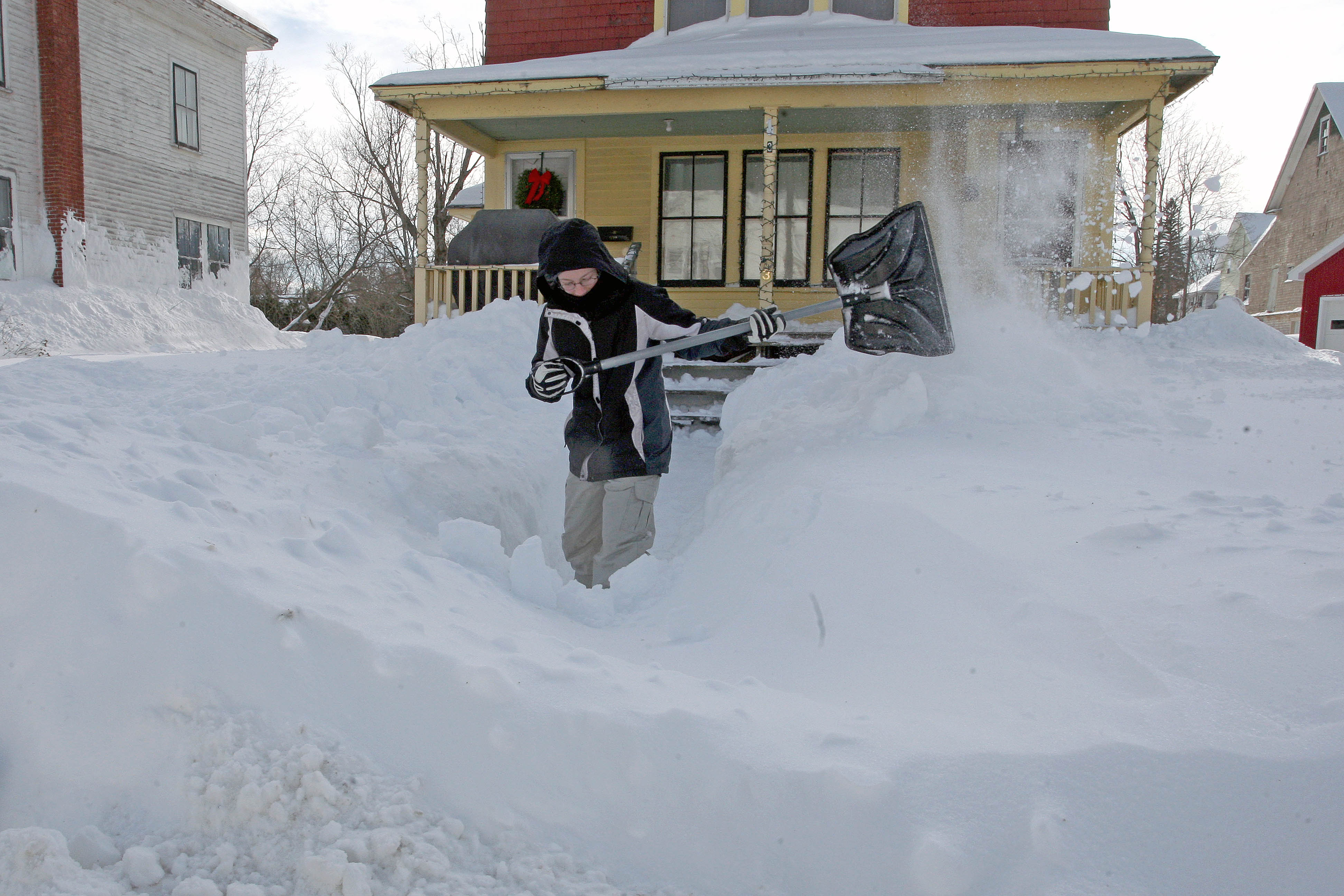
Sarah Harris of Houlton tries to clear the walkway to a home on Weeks Street Friday morning after more than a foot of snow fell in Houlton. (Joseph Cyr)
Stewart said because of the blowing snow Friday morning, some roads in the rural areas are down to one lane, so his department’s focus was to clean those areas up as best they could.
Many side roads in town were also narrowing because of the snowbanks. Stewart said it would be at least three or four more days before his department would be able to start hauling snow away.
“We probably have about a week’s worth of snow hauling to do,” Stewart said. “Then we will work on widening out the side streets by pushing the banks back.”
Sgt. Mark Gahagan of the Caribou Police said the department received several calls about cars off the road Thursday night into Friday, but no major injuries were reported. Gahagan said that police also received reports of two vehicles being abandoned in the road and that, as of Friday morning, officers were working to “find out who the owners are.”
The sergeant added that drivers likely abandoned their vehicles due to tow truck drivers being so busy pulling other cars out of the snow.

Hank King of Houlton shovels a sidewalk in downtown Houlton Friday morning. (Joseph Cyr)
While Mainers can expect a break from the snow for at least several days, temperatures and wind chills will be an issue.
“Basically, we’ve had our high for the day,” Norton said early Friday morning after temperatures hit the low 20s in southern and eastern Aroostook County.
By 3:30 p.m. Friday, the NWS had issued wind chill warnings for western and far northern Maine and wind chill advisories for the rest of the state.
Thursday afternoon, the NWS confirmed a report of thunder snow about 25 miles south of Bangor. Norton said thunder snow is rare but not unheard of and is essentially a thunderstorm with snow instead of rain.
Cold air is expected to last through Sunday, with Monday temperatures likely to reach 30 degrees in the Portland area, and perhaps 36 to 37 degrees on Tuesday.
“It’s looking like it will get back more to normal,” meteorologist Tom Hawley with the National Weather Service in Gray said Friday morning. “Then, at the end of the week, we’ll have snow changing to rain in southern Maine, and mixed in the mountains.”
Writer Beth Brogan of the Bangor Daily News contributed to this report.
-
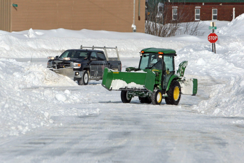
- Snow removal crews were out in force in Houlton Friday morning trying to clear more than a foot of new fallen snow. (Joseph Cyr)
-
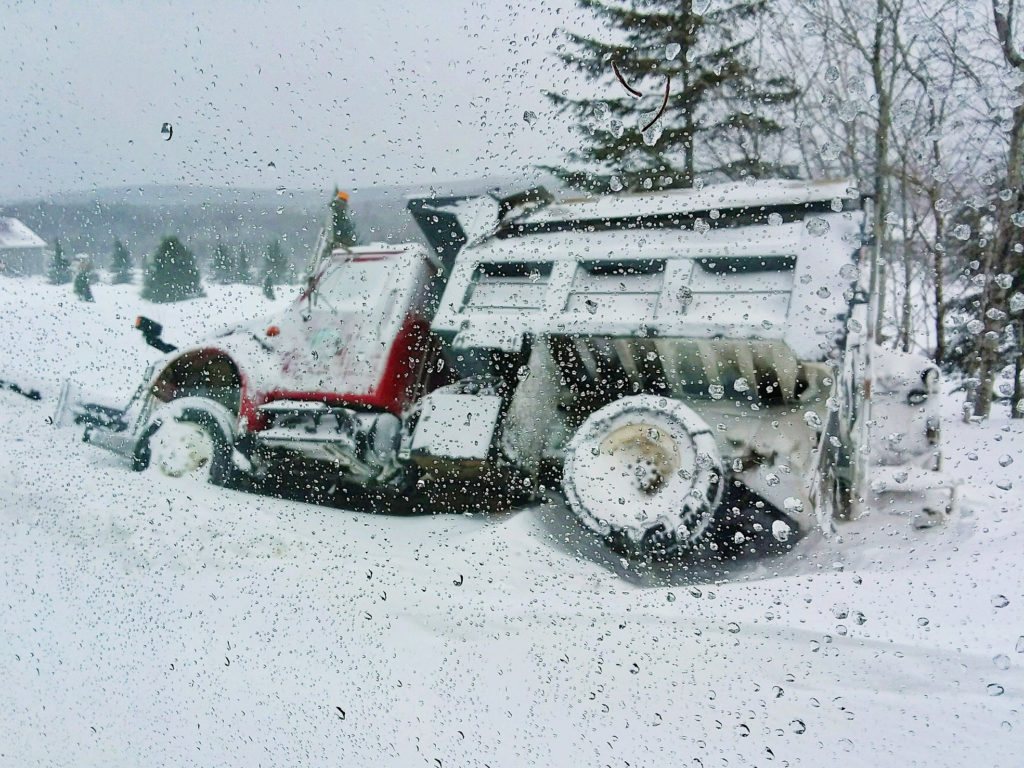
- This New Canada plow truck slid off the edge of Sly Brook Road on Friday morning. (Courtesy of Jaime Pelletier)
-
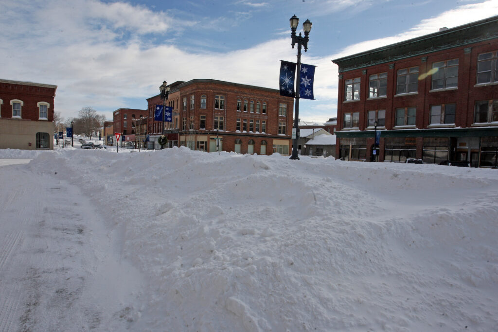
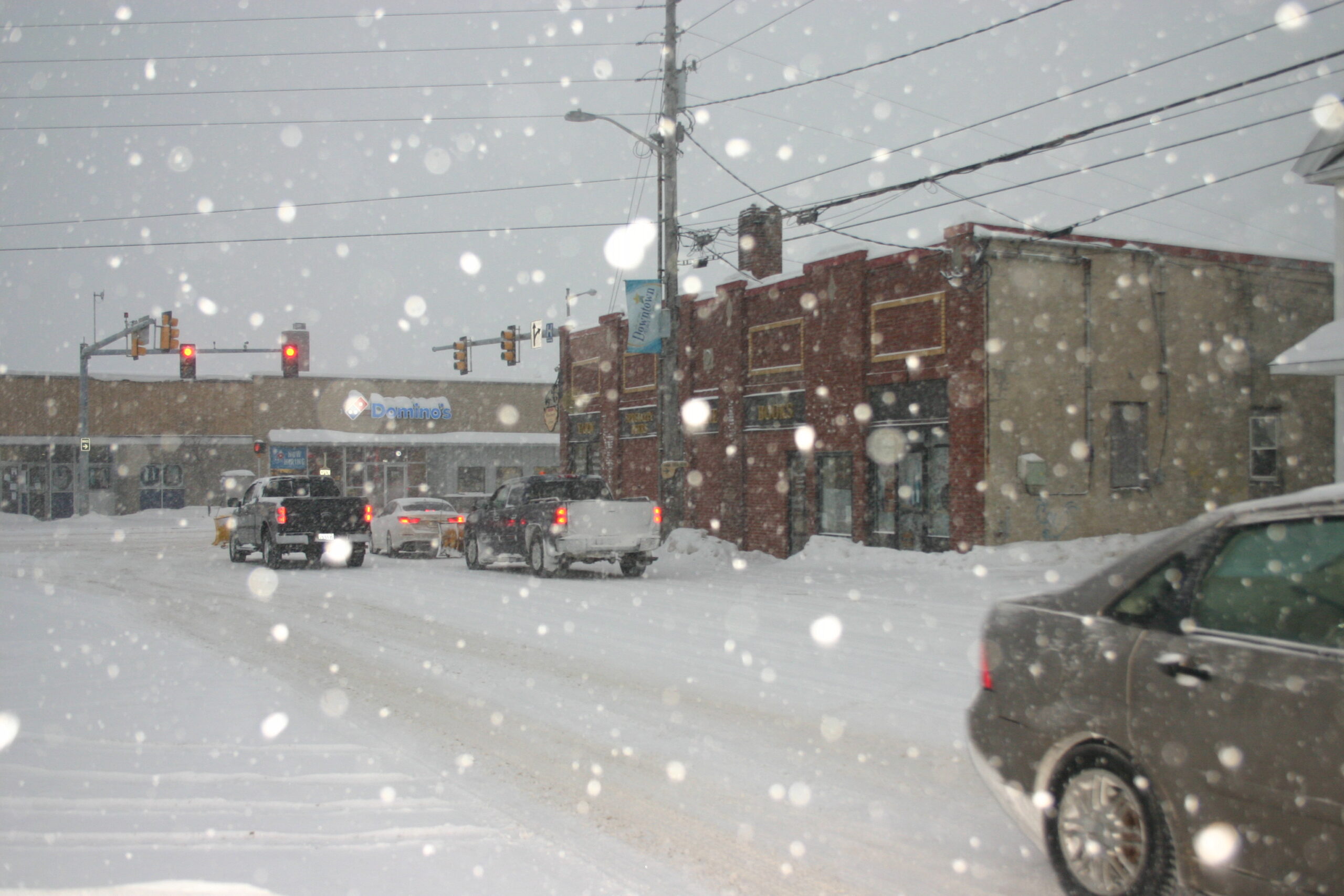
- Downtown Houlton was quite Friday morning following Thursday’s major winter storm. Parking in Market Square was limited because of the large amount of snow. (Joseph Cyr)
-
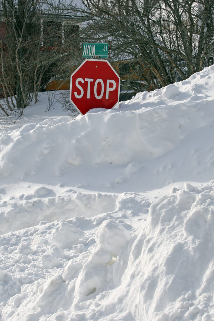
- A stop sign at the corner of Avon and Weeks streets in Houlton is barely visible following the first major snowstorm of the new year. (Joseph Cyr)