WASHBURN, Maine — Rising water levels, snowmelt, and a forecast of rain this weekend pose a “significant flood threat to all of Aroostook County,” according to Aroostook Emergency Management Agency Director Darren Woods.

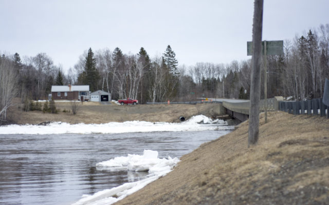
This portion of the Gardner Creek Road in Washburn is completely flooded, leading officials to close the road indefinitely until the water returns to a normal level.
(Chris Bouchard | Aroostook Republican)
On Thursday morning, the National Weather Service Office in Caribou issued an advisory for the Washburn area, reporting that the Aroostook River was at 18.25 feet, which is in the moderate flood stage.
The warning indicated that ice jams are still locked in place around Washburn, Crouseville and surrounding areas and that the river is continuing to rise.
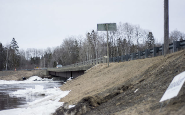
Parts of the Gardner Creek Road in Washburn have completely flooded, and the NWS advisory stated that “there is the potential for several structures along the river to flood” the road.

This portion of the Gardner Creek Road in Washburn is completely flooded, leading officials to close the road indefinitely until the water returns to a normal level.
(Chris Bouchard | Aroostook Republican)
“We’ve got several inches of rain coming over the next several days, from now and into the weekend,” said National Weather Service Meteorologist Tony Mignone. “We do think it’s going to add to the problem.”
He said the “bottom line” is that Aroostook County could face “much more significant issues as we go into the weekend,” and that aside from the Aroostook River, areas around the Mattawamkeag and St. John rivers could also pose a threat “depending on how much rainfall we get through the weekend.”
Woods said his agency is currently working with the town of Washburn to deal with their flooded roadways, adding that he met with Town Manager Donna Turner to look at different hazards in the town. The town’s highway foreman has since created a temporary road through Hilt Street to the Gardner Creek Road that is “very rough and only passable with a four wheel drive pickup,” according to Woods.

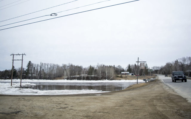
This portion of the Gardner Creek Road in Washburn is completely flooded, leading officials to close the road indefinitely until the water returns to a normal level.
(Chris Bouchard | Aroostook Republican)
In addition to the Gardner Creek Road, Woods said the Castle Hill Road between the state road and the Parsons Road is also experiencing flooding and that Route 2 in Island Falls and the Dyer Brook Bridge are still closed.
At this point, all motorists are urged to drive with caution through the weekend and to closely watch for any signs warning of a flooded or closed roadway.
“We’re doing everything we can to point out, or create, alternate routes,” said Woods, “and we are hoping people are prepared.”
He also suggested County residents check out the Aroostook County Flood Watch Facebook page for notifications about potential flooding emergencies. The public is also welcome to submit pictures to the site of floods or bodies of water that are near flooding.
-
- The National Weather Service issued an advisory early Thursday morning indicating that the water level of the Aroostook River in Washburn is at 18.25 feet, which is in the moderate flood stage. (Chris Bouchard | Aroostook Republican)
-
- The National Weather Service issued an advisory early Thursday morning indicating that the water level of the Aroostook River in Washburn is at 18.25 feet, which is in the moderate flood stage. (Chris Bouchard | Aroostook Republican)
-
- The National Weather Service issued an advisory early Thursday morning indicating that the water level of the Aroostook River in Washburn is at 18.25 feet, which is in the moderate flood stage. (Chris Bouchard | Aroostook Republican)