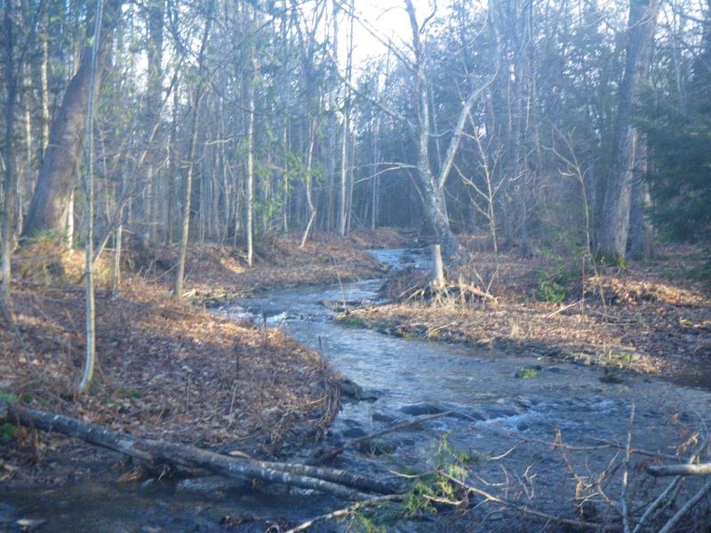
PRESQUE ISLE, Maine — Runoff from farming has harmed Aroostook River tributaries, and a local conservation district has a plan to keep soil in fields and out of the waterways.
With a $42,000 Environmental Protection Agency grant, the Central Aroostook Soil and Water Conservation District in Presque Isle surveyed four of the river’s 63 tributaries and devised a 10-year management strategy.
The work is vital to understand where the soil erosion comes from and how it affects each waterway, said Randy Martin, the district’s executive director. Martin recently completed a watershed management plan that aims to halt erosion, improve water quality and augment ongoing efforts to restore native fish like brook trout and Atlantic salmon.
“This is not a watershed plan for a river, but for its tributaries, [and] it’s the first time the EPA has given such a grant,” Martin said. “The grant paid for us to survey four tributaries of the Aroostook River. The majority are impaired because of the agricultural erosion washing into them.”
Soil buildup can impair water flow, block culverts and prevent fish from traveling, Martin said. The soil sediment and heavy stream flow can smother or wash away fish eggs. Soil also contains a lot of phosphorus, which leads to excessive algae.
Aroostook County has more than 300,000 acres of farmland, according to the U.S. Department of Agriculture’s 2022 survey. When that land is close to rivers and streams, erosion from storms, rainfall and snowmelt can carry soil into the waterways.
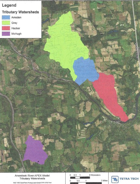
The district received the grant last summer and identified four tributaries to survey: Gray, Hacker and Amsden brooks in Fort Fairfield and a previously unnamed brook at Parkhurst Siding in Presque Isle, which the district calls McHugh Brook in honor of the family who farmed there for generations.
Those four sites were the most problematic of the Aroostook River’s tributaries and have the most farmland around them, Martin said.
Martin and his staff surveyed the brooks last summer with help from TetraTech, a Georgia-based engineering and consulting firm, which used topography to create a survey plan.
Soil erosion from last year’s heavy rainstorms affected all four areas, Martin said. Three of the brooks also have culverts that are perched above the water, which means water flow isn’t ideal except when water is high. That means fish like brook trout, which travel to smaller cold brooks when the waters are warm, can’t pass through.
“All aquatic life is hampered by the poor water quality in these brooks,” Martin said. “The goal is to restore Class B water quality to the brooks.”
The EPA defines water quality for streams and “wadeable rivers” in Maine by four classes. Class B, the third highest, means the water must be unimpaired and cannot adversely affect aquatic life. The water must support all species that are indigenous to the site.
Class AA refers to waters that are natural and warrant preservation due to recreational, ecological or aesthetic importance, while Class A waters must contain only naturally occurring species, according to EPA. Class C waters are listed as suitable for aquatic life but may cause changes to some plant and animal life.
Hacker Brook, which is close to the U.S. Customs and Border Patrol station in Fort Fairfield, was probably in the best shape of all, Martin said. Still, the brook has been downgraded to Class C due to poor fish habitat and too much algae.
Amsden Brook has a high level of algae, while Gray Brook, also in Fort Fairfield, has seen extensive erosion with a buildup of not only soil and silt, but rocks.
And in Presque Isle, McHugh Brook had the most extensive soil erosion, Martin said. The land is steep, which causes a lot of soil to migrate down toward the water.
The district’s watershed plan calls for stopping the erosion and unblocking, or even replacing, some of the culverts that are harming fish passage and other aquatic life. While DEP and EPA will likely address the culverts, farmers have a role to play, too.
The plan suggests farmers establish cover crops and plant on a schedule that allows oats, for instance, to start growing right after potato harvest. The new crop will take root and help prevent soil runoff after harvest, Martin said.
If a cover crop is not possible, spreading hay mulch over harvested fields will help keep the soil from migrating.
Other fixes might include changing row direction to hold field water in place, or building sediment ponds to collect soil that can then be reintroduced into fields.
The EPA and Natural Resource Conservation Service will help fund the installation of sediment ponds on farmland, Martin said. Each farm will likely have its own solution, but the overall goal is to keep the soil from the waterways.
The district will share its 10-year plan with the EPA, Maine Department of Environmental Protection and the municipalities involved. The agencies will collaborate with local officials to put the plan into action.
“There are new practices that will be introduced that may be a hard pill to swallow, but it’s what we have to do to keep the soil in the fields,” Martin said.
Correction: This story has been updated to correct the amount of the EPA grant.