While some flooding persists in low lying areas along the Fish River and its chain of lakes in Aroostook County, the water levels are receding and no more rain is in the forecast until later in the week.
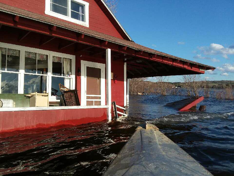
The Aroostook County Emergency Management Agency reported at least 30 homes and camps damaged by swelled waterways and ice last week and into the weekend at Portage Lake, Saint Froid Lake, Eagle Lake, Square Lake, Cross Lake, and Long Lake.
“The next chance of rain looks to probably be Thursday into Friday,” said Chris Norcross, meteorologist with the National Weather Service Caribou office. “It doesn’t appear to be a real heavy rain at this point. Between now and then we should have a dry stretch of weather.”

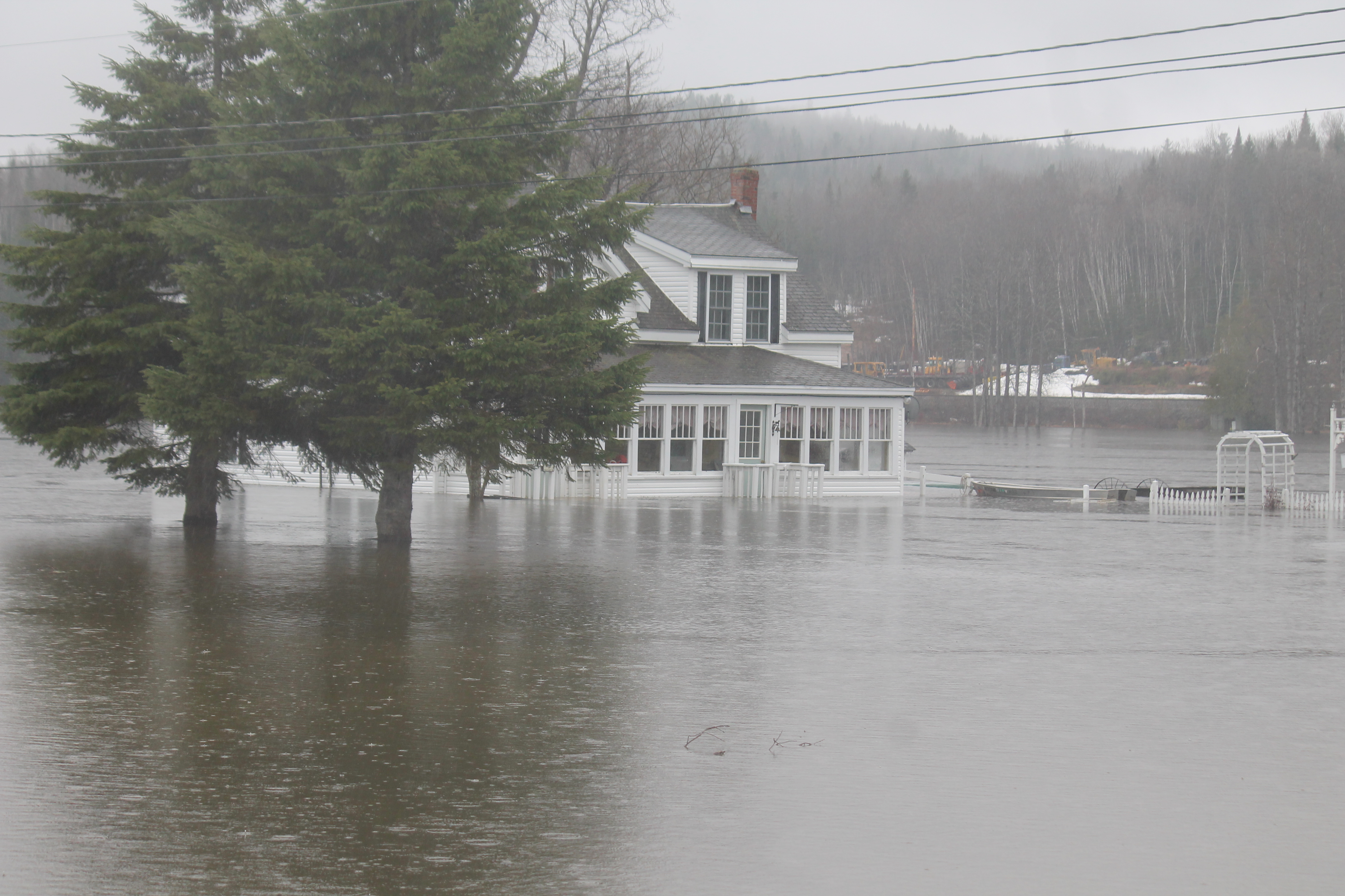
All residents of Bouchard Street in the Soldier Pond area of Wallagrass evacuated their homes this week due to flooding from the nearby Fish River. This vacated home stands surrounded by water on Thursday, May 3. (Jessica Potila)
That will allow waters that have been threatening areas of northern Maine for more than a week now to continue receding through the week.
All residents of Bouchard Street and several on Soldier Pond Road in Wallagrass evacuated their homes last week due to the swelling Fish River. The Maine Department of Transportation shut down the Fish River Bridge in that community on Monday, April 30, and it remained barricaded on May 7. Some people, however, were choosing to drive past the caution signs as water levels abated in the area, town manager Lana Voisine said Monday.
“I did notice this morning when I came in (that the water ) was receding,” Voisine said.
The town manager said the road will officially open again “as soon as the water goes down, depending on what (the road) looks like underneath.”
“Some people are still passing at their own risk,” she said.
The causeway leading from Beaulieu Road to Pelletier Island in St. Agatha also remained closed Monday morning. At least half of the residents of the 22 permanent homes on Pelletier Island chose to evacuate their homes last week after Long Lake overflowed.
While water levels had dropped there by Monday, weekend wind gusts as high as 35 miles per hour pushed chunks of ice from the lake onto the causeway.
St. Agatha town manager Aubrey Michaud said Monday that the structural effects to the causeway as a result of the flooding and ice movement has yet to be determined.
“It’s too soon to tell,” she said. “There’s still water on it so we won’t be able to tell for a little while.”

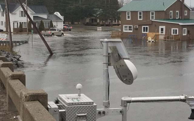
U.S. Geological Survey field crews installed a temporary rapid deployment gauge on May 2 at Soldier Pond in the Fish River to monitor flooding near Fort Kent.
(Courtesy of Andy Cloutier/USGS)
On Portage Lake, flooding and ice chunks moved by heavy winds caused significant damage to camps or homes, including “a half dozen buildings which were completely taken off the foundations,” according to town manager Larry Duchette.
Assessing damage and repairing the homes is not an option yet, Duchette said Monday.
“We can’t get to them yet; the water is still too high,” he said.
Portage resident Gerri Condon, who along with her husband Paul watches over several camps on the lake for owners who live away from Aroostook County, said the damage this year has been extreme.
Gerri Condon reported that one camp owned by a Vermont man had come off its cribbing and actually shifted in the water, coming close to hitting a neighboring camp.
“This is the worst I’ve ever seen,” she said. “We witnessed the two previous floods and the damage was minor compared to this. Furniture, rugs, flooring had to be replaced, but nothing like this year’s damage.”
“The water has been high before and not had this damage done, so I think the ice and wind has done most of the damage this year,” she added. “It’s really sad and heart wrenching to see the damage this year.”
Duchette, as with officials in other towns along the Fish River chain of lakes reported no known injuries to any individuals thus far as a result of flooding.
“I’m just glad everybody’s safe,” Duchette said. “This is an annual event for us on Portage Lake. We try to do the best we can with what we have.”
Fort Kent officials watched the Fish River closely throughout the past week as waters there rose just above 12 feet at its highest point. Minor flood stage is 11 feet for the Fish River and moderate flooding is at 12 feet. Town department heads met several weeks ago to establish plans should water levels overtake the town as happened in 2008.
Ten years ago, 3 inches of rain and fast-melting snow from a record snowfall that winter caused the St. John River to rise 8.1 feet in less than 24 hours and surge to 29.9 feet by evening on April 30. The Fish River also crested at a record 13.9 feet, with the combination of both overflowing rivers displacing hundreds of residents and causing millions of dollars in damage to buildings and infrastructure.
Town officials were prepared for a potential repeat this year, but thankful that it did not happen.
“I do think we averted major flooding last weekend into Monday,” Steve Pelletier, director of planning and economic development, said Monday. “If we had received even another inch of rain when the rivers were rising, (Tony Theriault, Fort Kent public works director) would have needed to make a decision about hauling gravel along Blockhouse Road to protect the downtown.”
Public works crews used gravel to create makeshift berms in 2008 that prevented flood waters from reaching more parts of town at that time. This year, flooding was contained to area such as Riverside Park and the Blockhouse picnic area.
“In terms of damage to residents and businesses, it was mostly homes along East Main Street and Meadow Lane where ground water entered basements, Pelletier said, adding that residents were able to pump out the water before too much damage could be done.

Rising waters of the Fish River in Fort Kent encroach on the Acadia Federal Credit Union, center, and B & M Apartments, left, in Fort Kent in this aerial image captured with a drone on Tuesday, May 1. (Charles Pelletier photo)
“Public works, water/wastewater, and the recreation department has some damage that will need to be dealt with once the water drops more and the roads dry up a bit,” he said.
Darren Woods, director of the Aroostook County Emergency Management Agency, said Monday that he has been monitoring the flood levels, gathering information from impacted towns, and coordinating with other agencies to try and secure federal funding to help those affected.
“Financial assistance for individuals is not going to happen, because we didn’t reach the impact needed for that kind of assistance,” Woods said.
He still is pursuing possible funding for infrastructure damage as a result of the flooding, but is unsure at this point whether or not the damage will reach the financial threshold to secure such assistance.
Despite the lack of federal funding to assist individuals affected by the flood along the Fish River chain of lakes, Woods said the ACEMA is trying to attain assistance from a volunteer organization, VOAD — Voluntary Organizations Active in Disaster.
“We live here too, so we want to do something to help,” Woods said. “This group might be able to send some people up that could help go to individual houses and help them with labor, help move some stuff, that kind of thing, but I won’t know that for sure until closer to the end of the week. They are going to be sending up a couple of assessment folks that will be driving around probably Thursday or Friday.”
Woods also issued a press release through ACEMA, cautioning County residents affected by flooding to take precautions as they return to their homes.
“Residents are reminded that there are potential hazards that should be considered when returning to a home or business following flooding, such as gas leaks, oil tank damage, electrical hazards, structural damage, and unsafe drinking water,” the press release states.
Woods posted information on the ACEMA Facebook page to assist homeowners in finding the right agencies and organizations to assist with such issues.
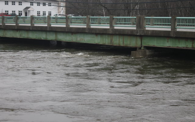
- Rising water flows just under the Fish River Bridge in Fort Kent on Thursday morning. (Jessica Potila)


