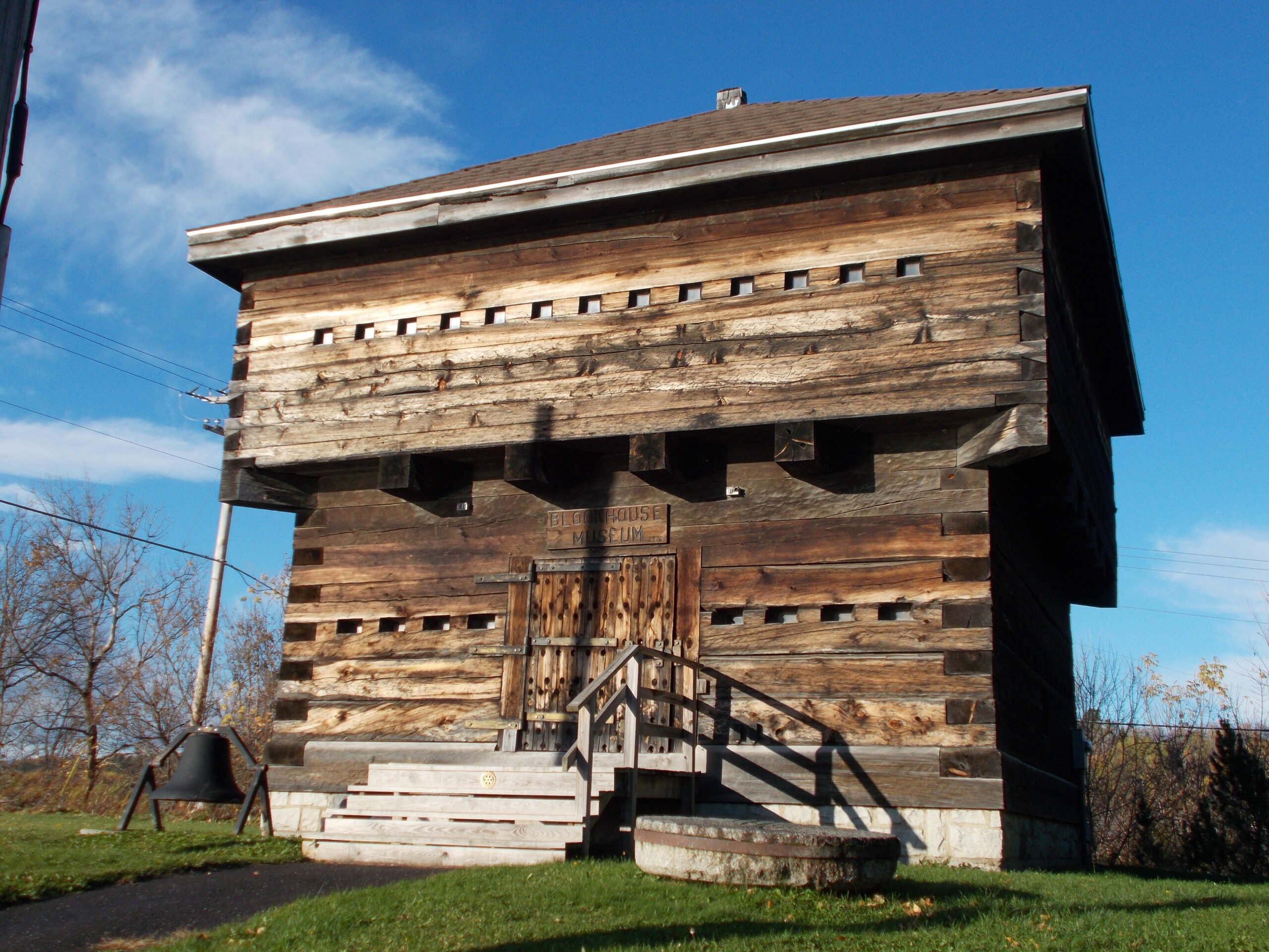
FORT FAIRFIELD, Maine — The replica of the blockhouse that once stood close to the Aroostook River looms large on Main Street in Fort Fairfield, its wide wooden frame revealing dozens of tiny windows neatly placed along all four sides. Today the building houses the museum of the Frontier Heritage Historical Society but also contains the story of when Maine and Canada were in dispute over where exactly the U.S.-Canadian border stood.
In 1783, the Treaty of Paris officially ended the American Revolutionary War and granted most of the territory east of the Mississippi River to the U.S., which doubled the size of the nation. But that treaty never designated a formal border between the U.S. and Canada, which Great Britain still owned at the time, and the American government never had anyone survey the land that connected the two countries.
Tensions between the countries simmered, as Canadians believed that the border ended where Mars Hill is today while the Americans claimed ownership of the northern land that extended to Fort Kent. The conflict came to a head in the winter of 1838 to 1839, when Canadian lumberjacks came to the Aroostook area to cut timber and began transporting the wood across the Aroostook River in Fort Fairfield and St. John River in Fort Kent.
In response, the United States government sent 50,000 soldiers, 10,000 of which were from Maine, to guard both rivers and put aside $10 million dollars to build blockhouses in both Fort Fairfield and Fort Kent and defend the American side of the border. In Fort Fairfield soldiers spent their days in the blockhouse and slept in barracks that were built on Fort Hill.
“I can imagine that a typical day must have been pretty boring for the soldiers because there wasn’t much that happened during this ‘war,’” Cathy Brohls, president of Frontier Heritage Society in Fort Fairfield, said.
The conflict is known today as the “the bloodless Aroostook War,” because none of the soldiers in Fort Fairfield or Fort Kent participated in any battles or lost their lives. But that period ultimately led to the formation of the U.S.-Canadian border as we know it today.
In 1842 U.S. Secretary of State Daniel Webster and British Foreign Minister Baron Ashburton met and later signed the Webster-Ashburton Treaty, which created the official boundaries between Maine and New Brunswick and authorized the U.S. control of 7,015 square miles of the disputed territory and 5,012 square miles to Canada. Though there were no physical battles during the “war,” Brohls noted one story in which there was a disagreement between the towns of Fort Fairfield and Fort Kent.
“There was a cannon that Fort Fairfield had, which they never used, but that Fort Kent believed was theirs and kept stealing,” Brohls said. “Somehow the cannon ended up back in Fort Fairfield and they put it on the lawn of the library.”
The historical society built a replica of the former blockhouse in 1976, around two feet from where the original stood, and a similar structure also exists in Fort Kent. Today the inside of Fort Fairfield’s rebuilt blockhouse contains donated artifacts from the town’s former drug store and grammar school as well as potato harvesting tools, a spinning wheel and old photographs of students and businesses.
Brohls noted that she is unsure of whether a formal border patrol system was set up in the years following the Aroostook War. The government sent away all soldiers after the Webster-Ashburton Treaty was signed and relationships between the two countries remained stable. In reflecting on the historical story, she said that even until recent years the requirements to cross the border were never as strict as those that came after the tragedy of 9/11.
“I remember that people didn’t even need a passport. You could just go freely across the border with very little IDs,” Brohls said. “I don’t know if there even would have been a border outpost after the Aroostook War.”


