Nearly 200 geologists are convening at the University of Maine at Presque Isle this weekend. But you won’t find them in a lecture hall.
Instead, those attending the 114th annual New England Intercollegiate Geological Conference will be out exploring geologic treasures in the rocks and mountains of northern Maine and western New Brunswick, Canada.
This is the second time the conference has come to Presque Isle and the first time it’s been hosted by the local campus. It isn’t your typical conference. Instead of a series of indoor presentations, the three-day event involves college faculty, students and geologists taking a series of field trips. That’s why it’s one of the most popular geologic gatherings in the Northeast, according to campus officials.
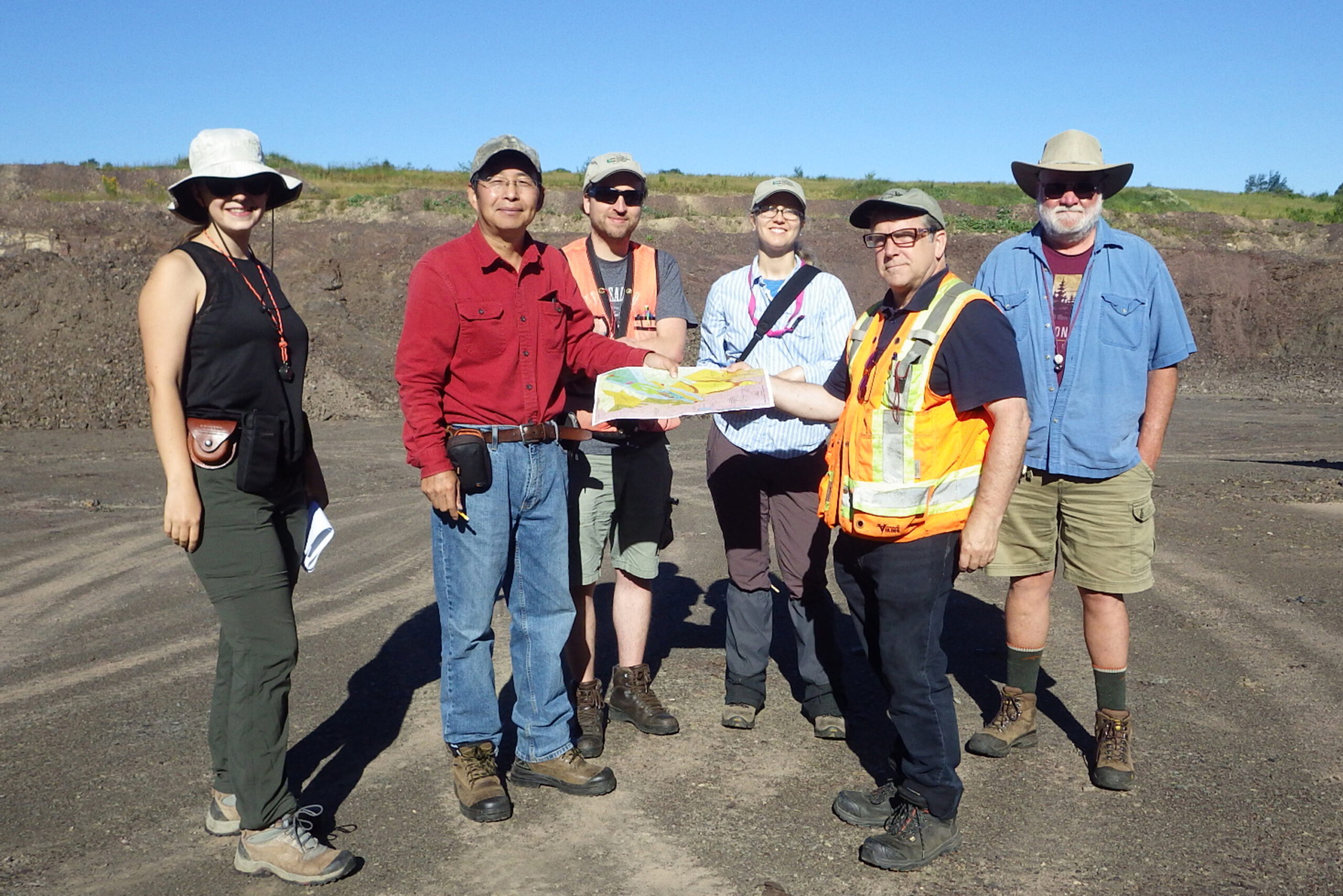
It’s also unique in that it’s international, said organizer Chunzeng Wang, professor of earth and environmental sciences at the Presque Isle university. He and co-organizer David Lentz of the University of New Brunswick have planned 12 field trips: nine in northern Maine and three across the border.
“To understand the entire northern Appalachian Mountains, we must know the true geologic story of northern Maine,” Wang said. “It turns out that we have important geological features other places don’t have.”
Wang has studied the region’s geology since 2016. Among its features are volcanic remnants and mineral deposits dating back 450 million years, he said.
Northern Maine has two important tectonic belts, one from Winterville to Munsungun, west of Masardis, and the other from Weeksboro in southern Aroostook to Lunksoos Lake in northern Penobscot County, Wang said. Both used to be volcanic areas, and their rocks show how the Appalachian mountains were built.
Some of The County’s formations and features aren’t found in other places, he said.
Aroostook County has four of Maine’s 10 most significant mineral deposits, according to the Maine Geological Survey. Volcanic rocks produced well-known metallic mineral deposits at both Bald Mountain and Pickett Mountain in northern Penobscot County.
Both mountains have been considered for mining operations, the latest being a proposed mine at Pickett Mountain, near Patten, by Canadian group Wolfden. The proposal has drawn protest from tribal communities, residents and state resource groups.
Another important site is the Aroostook Manganese District at Maple and Hovey mountains near Bridgewater, which contains more than 90 percent of the country’s manganese reserve, Wang said.
“The Maple-Hovey manganese deposit, located in the Number Nine Mountain area, is the largest manganese deposit in the United States, with the most manganese reserve in the U.S.,” he said.
Manganese, used in steelmaking and batteries, is one of the country’s 50 most critical minerals for economy and security, according to the U.S. Geological Survey.
Then there is Pennington Mountain, located in the unorganized township of Square Lake. Surveys in 2021 discovered niobium, zirconium and 17 rare earth elements, all of which are on the country’s critical mineral list, according to the Maine Geological Survey.
About 175 people from the Northeast and Canada’s Maritime provinces have signed up for field trips this weekend, Wang said, including to Pennington and Pickett mountains and the Maple-Hovey area.
He and Lentz will lead trips each day. Other leaders include David Putnam of the local campus, Robert Johnston of the Maine Geological Survey, Robert Marvinney of Readfield, Allan Ludman of Queens College in New York, Bryan Way of Toronto’s Canadian Manganese Company, and Wolfden Resources.
The conference will also honor five pioneers in northern Maine geology, and is dedicated to Marvinney, former Maine state geologist, and the late Gary Boone of Presque Isle.
Marvinney, retired since 2021, was among those who discovered the Pennington Mountain deposits. He had been a graduate student under Boone and was Maine’s state geologist for 26 years. Marvinney helped lead both airborne and magnetic resonance imaging geologic mapping projects in northern Maine, campus officials said.
Boone, who died earlier this year, mapped bedrock at Deboullie Mountain and in the Fish River Lake area in the 1950s, according to University of Maine at Presque Isle officials. While he taught geology at Syracuse University, he spent summers researching with the Maine Geological Survey. He was one of three editors of the bedrock geologic map of Maine.
A Saturday banquet on campus will honor Boone, Marvinney and three other pioneering geologists: the late Brad Hall, David Roy and Bill Forbes of Washburn, a longtime geologist and local university professor.
At a memorial service for Forbes in 2012, Boone wrote about Forbes’ lifelong fascination with fossils. He apprenticed at the U.S. Natural History Museum and discovered a new species of plant at Baxter State Park that was later named Psilophyton forbesii in his honor, according to Boone.
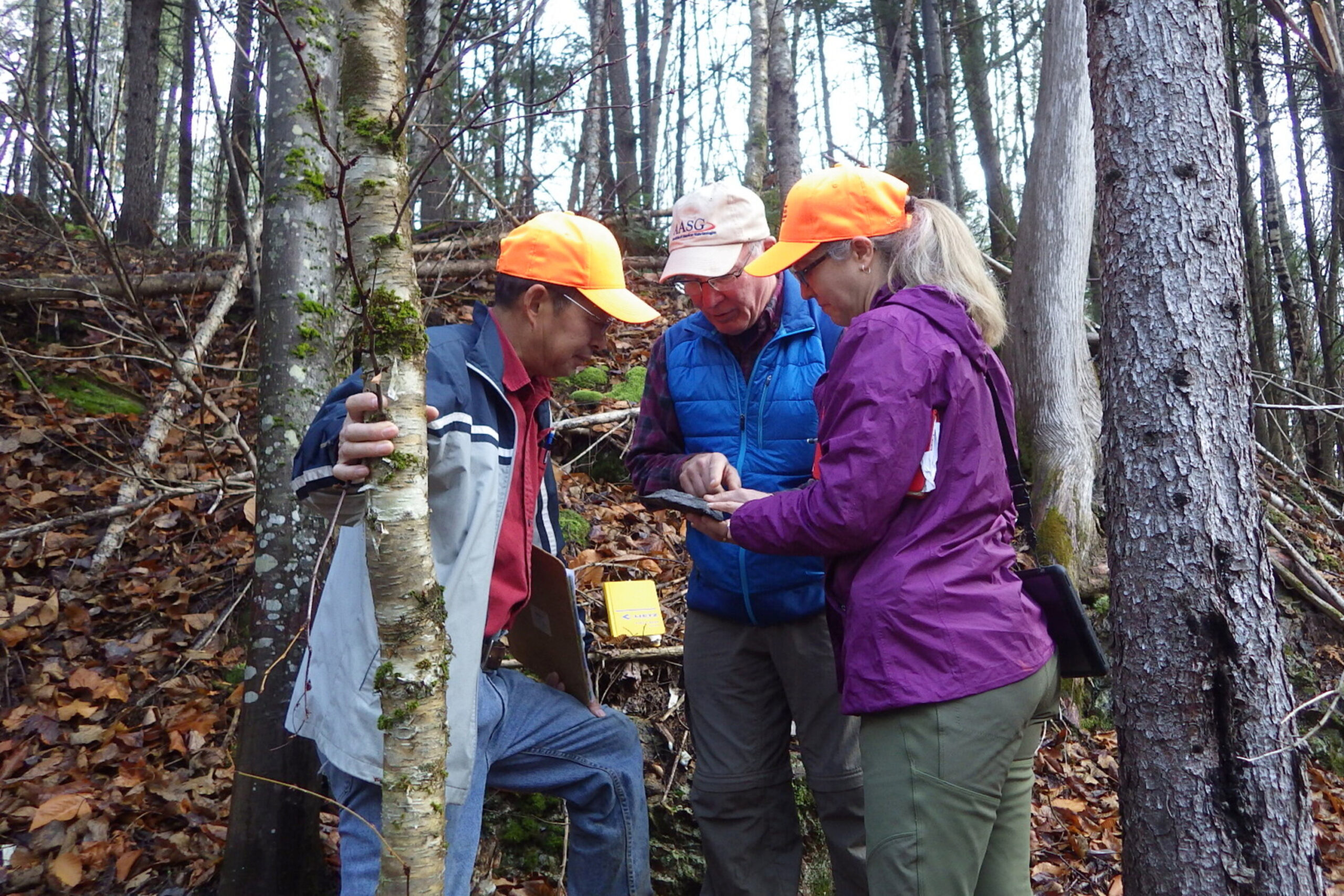
Wang is with a group in the Munsungan region today, and will also go to the Winterville and Maple-Hovey areas.
He loves being immersed in The County’s natural areas and even has an automatic email reply: “Out in the woods.”
And it’s good that he’s out there. He and his students have pioneered digital mapping, and among his discoveries is the St. Froid Lake formation, an area rich in plant fossils.
“The current geologic map in the area is about 90 percent inaccurate, and the geology is more interesting and also [more] complicated than thought,” he said. “Most of the time I feel like I am the pioneer geologist.”