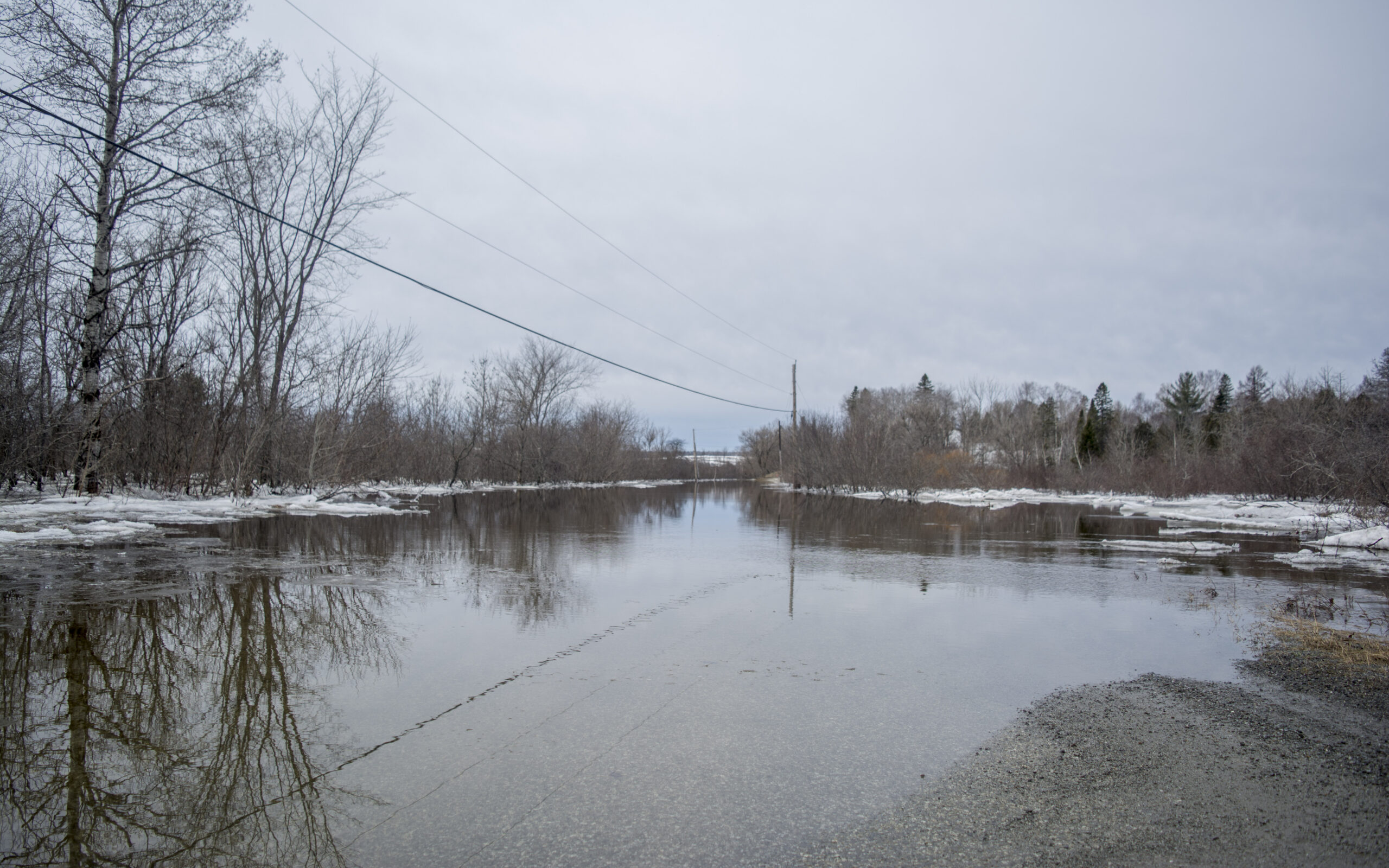
While the Aroostook River in Washburn has gone from moderate flood stage of 18.25 on Thursday to 16.74 feet Friday, a significant threat remains for low lying areas in Aroostook County this weekend as a forecast for rain combined with snowmelt may pose hazards for motorists.

This photo shows the beginning of an ice jam on the St. John River between Madawaska, Maine, and Edmundston, New Brunswick, on April 18. (Courtesy of Chris Michaud)
National Weather Service Meteorologist Tony Mignone said Friday that the weekend rain is the “biggest concern” in terms of a flooding threat.
“At this point it is quite concerning because there is still a lot of unmelted snow that rain and fog will release over the next several days,” Mignone said. “We’re still at a fairly heightened level of concern, there’s no change in that.”
An NWS flood watch issued Friday afternoon for northern and central Aroostook warns of the possibility of 1 to 2 inches of rain from early Saturday morning through Monday evening.
The combination of rainfall and “significant snowmelt will lead to significant rises on streams and rivers this weekend and into early next week,” according to the weather service. “Any rivers that still have ice will likely see the ice get flushed out this weekend as the flows increase. Until all of the ice gets flushed out of the rivers there will be the risk of ice jams and ice jam flooding. By late in the weekend and into early next week attention will turn to open water flooding.”
Meteorologists expect that smaller streams will flood and that some areas of northern Maine will experience “moderate to major open water flooding.”
Mignone said that there are concerns with the St. John River in Fort Kent, though not as bad as Washburn currently, and that emergency management officials are hoping some of the ice jams on the St. John will break loose soon or over the weekend.
While flying over the St. John River in a Maine Forest Service helicopter on Wednesday, Fort Kent Police Chief Tom Pelletier spotted a large ice jam just east of St. Francis. By Thursday, however, that ice jam had broken apart and floated downriver.
“It doesn’t appear that the ice in that area is a threat anymore,” he said Thursday. “The river is still being monitored and our concern right now is the forecasted rain this weekend.”
John Gibson, deputy director of the Aroostook County Emergency Management Agency said Friday that significant changes in water levels likely won’t be observable until late Saturday night or Sunday morning, but that the flooding potential is “enough to cause concern.”
“The main concern now is still in Washburn with the Gardener Creek Road and Castle Hill Road,” the deputy director said.
Mignone said that Washburn’s high water level Thursday was likely caused by an ice dam, and that by Friday it just below the moderate flooding range.
For motorists traveling through any areas with potential flood threats this weekend, the meteorologist warned motorists not to drive through any roads covered in water, and not to go around barricades.
Gibson offered similar advice, adding that any individuals living in low elevation areas around rivers “definitely want to keep themselves informed through the weekend,” and pay attention to local forecasts.
County residents can also check out the Aroostook County Flood Watch Facebook page for notifications about potential flooding emergencies.