CARIBOU, Maine — Residents of Aroostook County are watching area rivers and streams as ice jams, melting ice and impending rain could lead to rising rivers and potential flooding in some areas.
Greg Cornwell, meteorologist at the National Weather Service in Caribou, said that a wet weather pattern is expected through next week, with rainfall amounts expected to range from 1 to 3 inches. The highest totals will be across northern areas.
The combination of rain and snowmelt will lead to significant rises on streams this weekend, he said Saturday.
A flood warning for rain and snowmelt remains in effect until 8:45 p.m. Saturday for east central Aroostook County.
At 11:04 a.m., the Aroostook River at Washburn was at was at 17.5 feet. Flood stage is 14 feet. The Mattawamkeag River was at 14.25 feet. Flood stage is 13.5 feet. River levels will continue to rise over the next 36 hours, with a sharper rise expected to begin on Saturday afternoon.
Much of the state is under a flood watch, according to the weather service.
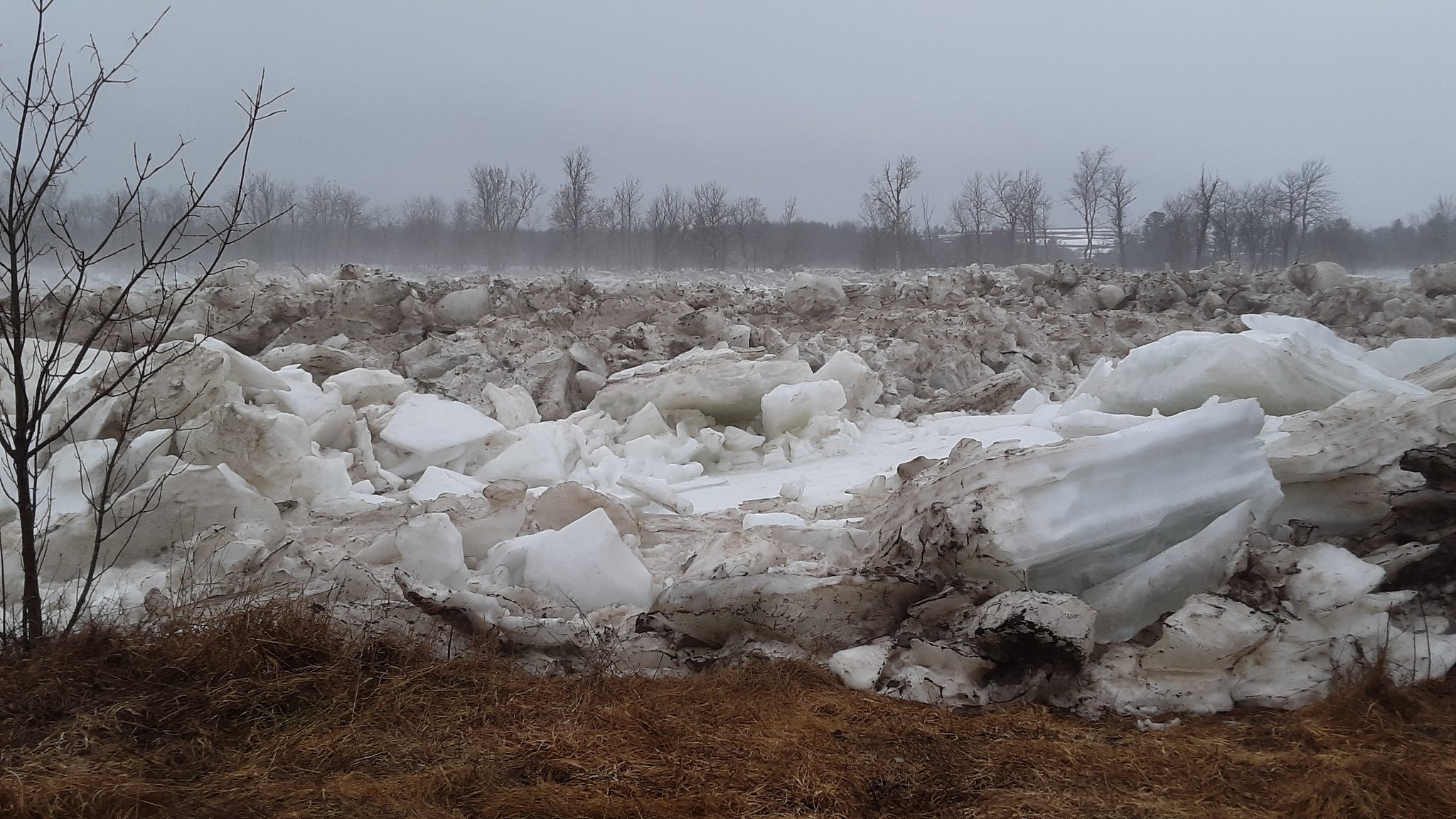
Aroostook County Emergency Management reported Saturday morning that Gardner Creek Road in Washburn was closed due to
an ice jam that extended from the 2 miles up the river from the Washburn bridge towards Crouseville. Emergency Management was also watching the Parsons Road and Wade Road in Washburn for possible flooding. The ice jam is currently located just up the river from the Washburn bridge with ice flows beginning to impact Wade Road.
In southern Aroostook, the Meduxnekeag River in Houlton was rising. The water was creeping up over the banks Saturday and onto the fitness paths in Riverfront Park. Forecasters said that low lying rivers and streams could threaten to spill over their banks next week.
Cornwell noted that residents should be cautious when encountering flooded roads and never drive through them in a vehicle. Be especially cautious at night when it is harder to recognize the dangers of flooding.


